

Covering...
Late March 2005
Overnighting Near Kilgore, Texas
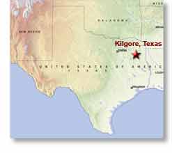 Thursday, March 3, 2005 - We left Tye, Texas this morning at 9am CST and arrived on the western edge of Kilgore, Texas at 3pm for a 6 hour 312 mile drive on excellent roads, all on I20 this time, almost a copy of yesterday's drive except for having to drive around Dallas/Fort Worth which certainly kept me awake with its traffic.
Abilene proved to be a pretty unexciting place with nothing particularly unique about it that we saw. So, like Laredo, these towns of Old West fame have simply become clones of most other modern-day cities, having Wal-Marts and Taco Bells on the edge of town and sterile glass and steel buildings downtown. A pity these places obviously have no sense of heritage.
They are predicting heavy thunderstorms for tonight. These should clear out by tomorrow morning when we are planning to leave for Vicksburg, Mississippi where we are most likely going to spend the weekend going down to Natchez and touring the Mississippi River a bit.
Overnighting Near Abilene, Texas
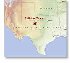 Wedneday, March 30, 2005 - We left Carlsbad, New Mexico this morning at 9am MST and arrived on the western edge of Abilene, Texas at 4pm CST for a 6 hour 315 mile drive on excellent roads, mostly I20, and got what I think is record mileage of 14.6mpg due to a very strong tailwind and an overall drop in altitude of nearly 1,500 feet.
We are actually in Tye, Texas which is on the northwest edge of Abilene and are planning to only spend the night here, staying in the Tye RV Park. However, there's some chance of rain in Dallas tomorrow and if so we may stay another day here until it passes.
We are now getting ready to head into Abilene to see if there's anything worth seeing and to find a wi-fi network to upload this update.
Current Plans
Monday, March 28, 2005 - As our plans are changing on a daily basis, today we signed on for one more day here in Carlsbad and the only thing that's likely to keep us from starting our return trek northward on Wednesday will be rain, which isn't in the forecast...as of today.
We are looking at heading due east along I20 to Jackson, Mississippi before turning northward which should put us in Ohio sometime in the April 4 to 6 timeframe, as of now.
We might however dawdle on the way and see some of the sights along the lower Mississippi River while we're that close to it, so this schedule is still not cast in stone.
The only thing that is fixed is we have to cross the Canadian border on April 17 or sooner.
This 'n That from Carlsbad, New Mexico
 Saturday, March 26, 2005 - Brrr!!! It's late afternoon and a storm moved through earlier in the day and the temperature has since dropped to 40°F/4°C and is supposed to continue to drop during the night to below freezing. So much for it being spring. Yeesh!
Anyway, nothing else new to report except we've signed up to extend our stay here until Tuesday morning. I noticed on a drive down to the Guadalupe Mountains for sunrise photos yesterday morning that the truck is already due for its next scheduled maintenance service appointment so we have to stay and have that done Monday here in Carlsbad. We did an incredible amount of driving in west Texas and the Big Bend.
So barring bad weather, we'll start our return trek northward on Tuesday.
And for nephew Nick, here's a photo of Sandra, his godmother, that I took in Fort Davis, Texas while we were having dinner in a Mexican restaurant there after seeing the McDonald Observatory.
Tomorrow, I'm planning on returning to the Carlsbad Caverns for more photos.
We See Our First Snow of the Winter!
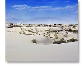 Thursday, March 24, 2005 - You might think from the headline that I was referring to the photo on the right, but that's sand actually.
Yesterday, Sandra and I (and Bib too) saw a large portion of southeastern New Mexico, a trip all told of 400 miles (640 km). And when I say saw it, I do mean seeing it because you can often see for 60 or 70 miles (95 to 110 km) and even further in any direction, so we literally saw an incredible amount of territory by day's end, just most of it from a distance.
The Drive
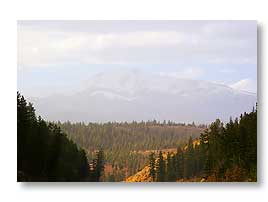
The drive itself went north from Carlsbad to Artesia, west to Alamogordo through the Sacramento Mountains which is where we saw our first snow of the winter (although it's actually Spring now), south to White Sands National Monument (which was where the photo above was taken), north again through Alamogordo to Tularosa, where we turned east taking a more northern route back through the Sacramento Mountains, seeing the very interesting town of Ruidoso (think Gatlinburg about 30 years ago) and the snow-capped 12,000 foot peak of Sierra Blanca (photo, sort of, below right), eastward to Roswell (where we saw no strange lights), and then south back to Carlsbad.
Change of Plans
It was a most interesting drive, but today we are both exhausted from it, so we're probably going to extend our stay in Carlsbad now until Monday so we can get some rest, rather than leaving on Saturday as we'd first planned. There's still a lot here I want to photograph.
Cell Phones
In addition to seeing some sights, our trip yesterday was also to visit the nearest Verizon store (Alamogordo and a 150 mile, 240 km drive) to get some definitive answers on our cell phones, answers which we got, although the first salesperson we talked with gave us misinformation but at least directed us to personnel who did have the facts.
Today's cell phones are marvels of technology but they are also much too complicated, as far as I'm concerned, with far too many features for old folks like Sandra and me to keep straight. In fact, one of the service people who knew what she was doing still managed to screw up Sandra's phone which fortunately we discovered before leaving the area and managed to find someone more technically competent on our return visit to Verizon. Yeeesh!.
Massive Dust Storm
Anyway, probably the biggest event of a very eventful day was the wind, 35mph (60kph) gusting to what felt like 200 but was probably a bit less than that. This made doing even simple things difficult, like merely opening the truck door. But the worst of what it did was ruin the scenery on our return drive because it blew up a massive dust storm off the white sands.
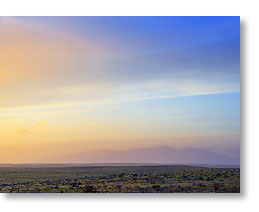
You can see it in these photos where the white gypsum dust is partially to almost completely obscuring the mountains in the distance. The thing is, the dust in the top photo was where it was originating at White Sands and the second photo was taken hours later at sundown and something like 80 to 90 miles (130 to 145 km) to the east of White Sands, which means it had blown through the Sacramento Mountains, something I thought couldn't and wouldn't happen!
But it did, and ruined any chance of getting a good shot of Sierra Blanca (the third photo), a most imposing and impressive mountain, the scale of which I had no idea was in this part of New Mexico and I'd sorely wanted some good photos of it. We did manage to get quite a bit closer to it, although we were told the vantage point I took this photo from was the best one, and even closer it was still too obscured to be a good photo. Oh well (sigh), maybe next time.
The wind and ensuing dust storm also made it quite a chore to take photos at White Sands. I at least had the forethought to wrap my camera in a towel before taking it out into what was there a full-blown sand storm. Otherwise the camera would have been sandblasted, or at the very least gotten sand into all its moving parts. As it was, it was Sandra and me that got sandblasted and we both could only endure about 20 minutes out in that invironment, which was a pity because it was a beautiful place. Oh well (sigh again), maybe next time too.
The Desert
Also, in the second picture you can see the northern region of the Chihuahuan Desert (as usual, click on the photos for larger images). The Chihuahuan Desert is the largest desert in North America and extends from southern New Mexico and Arizona southward through west Texas (including Big Bend) and into the state of Chihuahua in Mexico where the bulk of the desert is located.
In this desert you can drive for mile after mile after mile and what you see in the second photo is all there is. It is not unusual to drive for 40 to 50 miles and see no houses or roads, just desert scrub and the occasional ranch entrance and numerous oil wells.
Oil...Lots of Oil
Which brings me to another point I keep forgetting to mention. I thought the US was pumped dry for oil, but we have seen countless oil wells pumping merrily away, as well as quite a few new wells being dug, not only in Texas but here in New Mexico too. Quite puzzling.
We Do the Caverns & Mountains
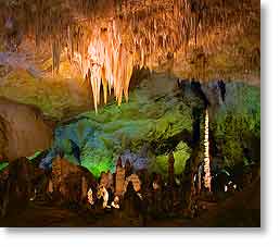 Wednesday, March 23, 2005 - Yesterday Sandra and I drove down to see the Carlsbad Caverns and Guadalupe Mountains National Parks.
I wouldn't say that seeing the Carlsbad Caverns has been a lifelong dream of mine, but they are a place I've heard about all my life and thought they would be interesting to see.
I was right. They are quite interesting and I'm glad we did get to see them, although Sandra likes Mammoth Cave National Park in Kentucky better. Both are definitely huge cave systems, but as I remember Mammoth Cave, it doesn't have nearly the number and quality of stalactites and stalagmites that we saw in Carlsbad.
After spending maybe an hour walking through the cavern's Big Room, Sandra decided she'd walked enough because her of her back complaining, so we decided to drive on down to see the Guadalupes.
 First though, we made a lunch and tourist stop at White's City, which is a very forgettable little tourist trap by the entrance to the caverns park, although it does have a bit of the southwestern look, something there's little of in Carlsbad the city.
After buying a few items and having a bite of lunch, we did the 45 minute drive south to the Guadalupe Mountains National Park which is across the border in Texas.
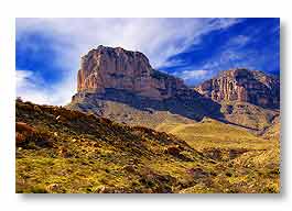
These mountains are interesting but not nearly to the scope and variety of the mountains in Big Bend. The best of the Guadalupes is the El Capitan peak, shown here. According to the geologists it was once a barrier reef in an ancient sea.
Today, we are planning to drive over to Alamogordo to see a bit more of New Mexico. Then tomorrow I'm expecting a long day of shooting photos - dawn at the Guadalupes, midday at the caverns, then sunset back at the Guadalupes. Friday will be a day of recovery and starting to prepare to leave sometime on the weekend to begin our trek back northward.
We Do the Zoo
 Tuesday, March 22, 2005 - Yesterday, Sandra and I visited the Living Desert Zoo & Gardens State Park here in Carlsbad, New Mexico. This park features flora and fauna indigenous to the Chihuahuan Desert.
Everything we had read about the park said it was worth seeing and that proved to be the case. It was quite interesting, although the wind was blowing so hard it actually made things difficult that normally would have been easy.
Like, I couldn't change lenses on the camera for fear of dust blowing into it and getting on the sensor, so I was stuck with the telephoto lens that I started out with since it's the best lens for photographing animals in a zoo (and in the wild). And let me tell you, the southwest is a windy and dusty place. No doubt because it is very dry here and the ground cover never completely covers the ground and very few trees for windbreaks.
 Anyway, I'm featuring Sandra's photos this time. As usual, click on them for larger views.
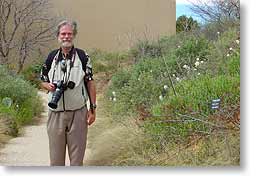
Above is one she took of me as we were leaving the zoo's visitor center and starting the self-guided tour.
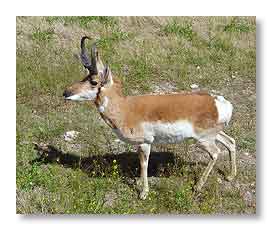
To the right is a Pronghorn Antelope, which is a very interesting animal. They are rather funny because like nearly all animals they are afraid of man, but they also have a highly developed sense of curiosity, so even in the wild they want to check you out at the same time they are equally afraid of you. It is amusing to watch their curiosity battle their fear.
We also saw bison, mule deer, prairie dogs, bobcats, a mountain lion, javelinas, eagles, and all kinds of small birds, just to name the ones that come to mind, as well as nearly all the plants and flowers we'd seen down in Big Bend. Now if I could only remember the names of all them.
Unfortunately, while the docile animals were in open areas with unobstructed views and the docile birds were in a walk-through aviary, the more dangerous creatures (and therefore most interesting) were behind chainlink which made taking good photos of them extremely difficult even when possible. Pity.
We are soon going to see the caverns and drive down to the Guadalupe Mountains National Park in Texas as well as driving over to Alamorgordo, New Mexico. We checked with the caverns' office here in town yesterday to see if tripods were permitted to be used in the caverns and were told they were in area we would be seeing, so hopefully I'll get some good photos there.
__________________________
For Older News
To read details of our previous stops and camps, visit the News Archives.
Updated
Copyright © 2005 by Gordon L Wolford .
All rights reserved.

Feedback
Just want to say 'Hi?'
Suggestions?
Comments?
 Our Photos Online
Sandra has begun posting
some of the photos she's
taking on our travels and can
be seen by clicking here.
And click here to see my
general and travel
photo galleries on pBase.
 Didya Know?
On February 7, 1969 a
meteorite weighing over
1 ton fell in Chihuahua,
Mexico.
Only 55% of all Americans
know the sun is a star.
1st man-made object into
orbit was Sputnik I in 1957.
 A Spot 'O Humor
Banning the bra was
a big flop.
Santa's helpers are subordinate clauses.
 Parting Thot
Advice is like castor oil,
easy to give, but
dreadful to take.
- Josh Billings